-
PHOTOS: Olympic Flame to travel to France on beautiful historic ship
The 127-year-old ship sets sail on Saturday with ‘the most important passenger it has ever carried’
-
Phone scams, gardening, insurance claims: 5 French practical updates
Our roundup of recent practical articles you may have missed
-
Picnic in Paris? Chance to join huge meal on Champs-Elysees
The event could even be record-breaking. You can now apply for your chance to take part
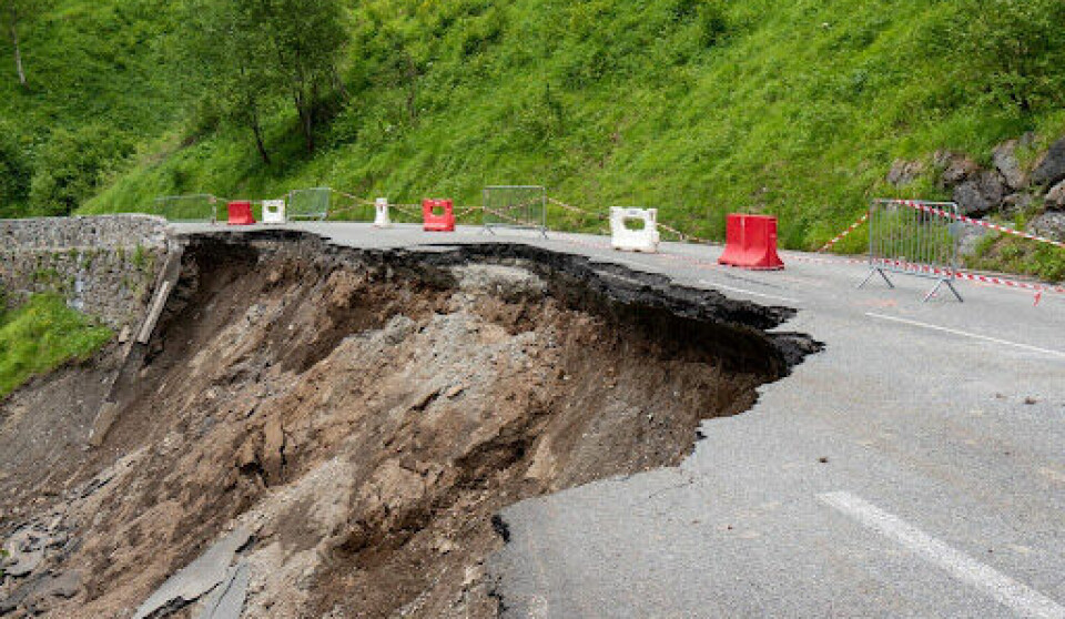
Month of rain set to fall in southern France and snow at low levels
Heavy ‘cévenol’ storms have already hit coastal areas with gales of 120 km/h

Storms in the south and south-east of France began last night and weather conditions are set to worsen throughout today (March 26).
Overnight, gusts of over 100 km/h were felt along the Mediterranean coastline, specifically in the Hérault and Var departments. The strongest winds recorded were 124 km/h in Porquerolles (Var).
Waves of up to four metres high hit Hérault and intense rain has begun falling in the Cévennes.
The storms will begin to affect the south-east on Tuesday morning, particularly along the Italian border and the Alpine foothills. In the Alps, heavy snow will fall at altitudes of 1,200m.
‘One month’s worth of rain’ in Massif Central
Rainfall will be at its heaviest today, say forecasters at La Chaîne Météo (owned by Le Figaro), especially in the Cévennes and the Alpes-Maritimes department.
In the Cévennes, up to 150mm of rain will fall by Wednesday (March 27) afternoon in some valleys.
This is the equivalent of a month of average rainfall in under 48 hours.
The Gard and Hérault will also see brief periods of extremely heavy rain.
These departments were heavily affected by storms earlier this month when seven people died, most of whom were in their cars.
Read more: Storm death toll rises in France as hunters find body of man in south
Coastal areas will continue to be hit by strong winds until Wednesday, with gales reaching 130 km/h along the Gulf of Lion.
Storms bring snow to south-east
These cold and heavy gales will push the storms eastward, with departments close to the Italian and Swiss borders facing rainfall and strong winds until Wednesday evening.
The bitter winds will bring snow to lower than usual altitudes for April.
Areas at around 800m above sea level, in both the Cévennes and Alpine foothills will see snow overnight between Tuesday and Wednesday.
Throughout Wednesday snow is expected at 600m around Grenoble and Chambéry.
Up to a metre of snow is also expected in the Pyrénées by Friday evening.
Currently, only Hérault is facing a heightened weather warning, for coastal waves.
It is likely, however, that increased warnings will be put in place throughout the day as weather conditions change.
During periods of intense weather, Météo France frequently updates the warning levels of areas affected.
Read more: What action is advised with different Météo France weather warnings
You can keep up to date with the latest warnings via the official Météo Francewebsite.
Related articles
What to do (and not do) during heavy rain and flood alerts in France
France’s state weather forecasters on strike over automation errors